


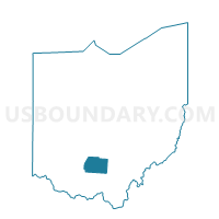
BUCKSKIN SOUTH Voting District, Ross County, Ohio
About
Outline

Summary
| Unique Area Identifier | 651417 |
| Name | BUCKSKIN SOUTH Voting District |
| County | Ross County |
| State | Ohio |
| Area (square miles) | 23.70 |
| Land Area (square miles) | 23.68 |
| Water Area (square miles) | 0.01 |
| % of Land Area | 99.95 |
| % of Water Area | 0.05 |
| Latitude of the Internal Point | 39.33275010 |
| Longtitude of the Internal Point | -83.29097410 |
Maps


Graphs
Select a template below for downloading or customizing gragh for BUCKSKIN SOUTH Voting District, Ross County, Ohio


Neighbors
Neighoring Voting District (by Name) Neighboring Voting District on the Map
- BUCKSKIN NORTH Voting District, Ross County, OH
- BUCKSKIN SOUTH SALEM Voting District, Ross County, OH
- CONCORD ROXABELL Voting District, Ross County, OH
- Voting District GREENFIELD 1 NE, Highland County, OH
- Voting District GREENFIELD 3 SW, Highland County, OH
- Voting District MADISON N, Highland County, OH
- PAINT TWP Voting District, Ross County, OH
- TWIN CENTRAL Voting District, Ross County, OH
Top 10 Neighboring County Subdivision (by Population) Neighboring County Subdivision on the Map
- Madison township, Highland County, OH (6,725)
- Concord township, Ross County, OH (4,460)
- Twin township, Ross County, OH (3,384)
- Buckskin township, Ross County, OH (2,039)
- Paint township, Ross County, OH (1,363)
Top 10 Neighboring Place (by Population) Neighboring Place on the Map
Top 10 Neighboring Unified School District (by Population) Neighboring Unified School District on the Map
- Greenfield Exempted Village School District, OH (12,428)
- Adena Local School District, OH (6,726)
- Paint Valley Local School District, OH (6,119)
Top 10 Neighboring State Legislative District Lower Chamber (by Population) Neighboring State Legislative District Lower Chamber on the Map
Top 10 Neighboring State Legislative District Upper Chamber (by Population) Neighboring State Legislative District Upper Chamber on the Map
Top 10 Neighboring 111th Congressional District (by Population) Neighboring 111th Congressional District on the Map
Top 10 Neighboring Census Tract (by Population) Neighboring Census Tract on the Map
- Census Tract 9557, Ross County, OH (5,677)
- Census Tract 9544, Highland County, OH (4,177)
- Census Tract 9545, Highland County, OH (3,990)